


2021-11-26_19h35m21_SityTrail - 2278531 - chamarandexlardy

jpcccb
User
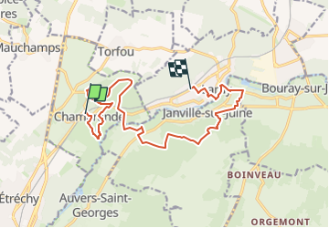

Length
14.4 km

Max alt
151 m

Uphill gradient
228 m
Km-Effort
17.4 km

Min alt
58 m

Downhill gradient
229 m
Boucle
No
Creation date :
2021-11-26 18:35:21.328
Updated on :
2023-05-09 13:01:24.797
4h10
Difficulty : Difficult

FREE GPS app for hiking
 SityTrail
IGN / Geographical institutes
SityTrail Plus
The world is yours!
About
Trail Walking of 14.4 km to be discovered at Ile-de-France, Essonne, Chamarande. This trail is proposed by jpcccb.
Description
Parc de Chamarande, château, belvédère, GR 655, Gillevoisin, bois de Pernaison, pierre levée, château du Mesnil Voisin, la Juine.
Positioning
Country:
France
Region :
Ile-de-France
Department/Province :
Essonne
Municipality :
Chamarande
Location:
Unknown
Start:(Dec)
Start:(UTM)
442108 ; 5373768 (31U) N.
Comments