


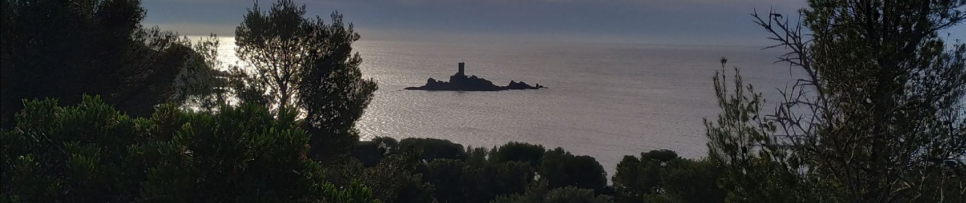
saint raphael /les ferrieres / belvédère du Dramont

Michel DUBOIS
User
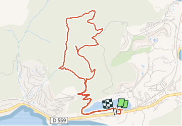

Length
8.8 km

Max alt
166 m

Uphill gradient
242 m
Km-Effort
12 km

Min alt
22 m

Downhill gradient
243 m
Boucle
Yes
Creation date :
2021-12-02 08:03:47.251
Updated on :
2025-06-09 15:51:17.311
2h44
Difficulty : Medium

FREE GPS app for hiking
 SityTrail
IGN / Geographical institutes
SityTrail Plus
The world is yours!
About
Trail Walking of 8.8 km to be discovered at Provence-Alpes-Côte d'Azur, Var, Saint-Raphaël. This trail is proposed by Michel DUBOIS.
Description
parking cul de sac D100 apres la carriere
Photos


Positioning
Country:
France
Region :
Provence-Alpes-Côte d'Azur
Department/Province :
Var
Municipality :
Saint-Raphaël
Location:
Unknown
Start:(Dec)
Start:(UTM)
324831 ; 4811209 (32T) N.
Comments