


Arville 021221

guyernage25
User
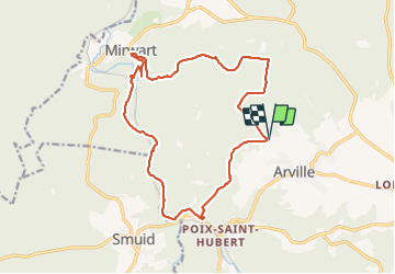

Length
16.4 km

Max alt
487 m

Uphill gradient
334 m
Km-Effort
21 km

Min alt
266 m

Downhill gradient
333 m
Boucle
Yes
Creation date :
2021-12-02 07:58:21.003
Updated on :
2021-12-02 12:33:37.933
4h13
Difficulty : Medium

FREE GPS app for hiking
 SityTrail
IGN / Geographical institutes
SityTrail Plus
The world is yours!
About
Trail Walking of 16.4 km to be discovered at Wallonia, Luxembourg, Saint-Hubert. This trail is proposed by guyernage25.
Description
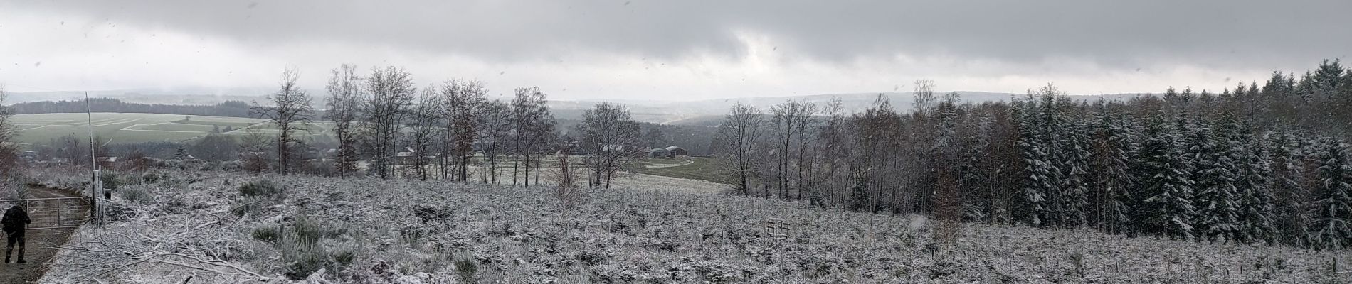
Belle rando forestière sous la neige
Photos


Positioning
Country:
Belgium
Region :
Wallonia
Department/Province :
Luxembourg
Municipality :
Saint-Hubert
Location:
Unknown
Start:(Dec)
Start:(UTM)
665324 ; 5545493 (31U) N.
Comments