


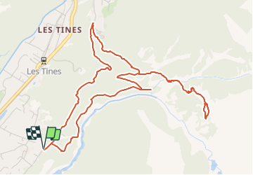
13 - Les gorges de l'Arveyron-le Chapeau

geranimo
User

Length
6.9 km

Max alt
1587 m

Uphill gradient
495 m
Km-Effort
13.5 km

Min alt
1104 m

Downhill gradient
495 m
Boucle
Yes
Creation date :
2021-12-03 17:17:22.913
Updated on :
2022-01-24 18:12:43.904
3h04
Difficulty : Difficult

FREE GPS app for hiking
 SityTrail
IGN / Geographical institutes
SityTrail Plus
The world is yours!
About
Trail Walking of 6.9 km to be discovered at Auvergne-Rhône-Alpes, Upper Savoy, Chamonix-Mont-Blanc. This trail is proposed by geranimo.
Positioning
Country:
France
Region :
Auvergne-Rhône-Alpes
Department/Province :
Upper Savoy
Municipality :
Chamonix-Mont-Blanc
Location:
Unknown
Start:(Dec)
Start:(UTM)
337157 ; 5089864 (32T) N.
Comments