


7

Divio
User
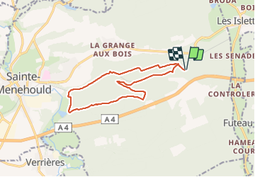

Length
12.7 km

Max alt
253 m

Uphill gradient
231 m
Km-Effort
15.8 km

Min alt
137 m

Downhill gradient
233 m
Boucle
Yes
Creation date :
2021-12-07 07:58:29.232
Updated on :
2021-12-07 10:25:59.372
2h27
Difficulty : Very easy

FREE GPS app for hiking
 SityTrail
IGN / Geographical institutes
SityTrail Plus
The world is yours!
About
Trail Nordic walking of 12.7 km to be discovered at Grand Est, Marne, Sainte-Menehould. This trail is proposed by Divio.
Positioning
Country:
France
Region :
Grand Est
Department/Province :
Marne
Municipality :
Sainte-Menehould
Location:
Unknown
Start:(Dec)
Start:(UTM)
644255 ; 5439865 (31U) N.
Comments