


211209 Havelange

guy284
User
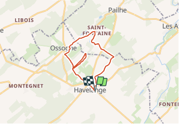

Length
11 km

Max alt
315 m

Uphill gradient
243 m
Km-Effort
14.2 km

Min alt
219 m

Downhill gradient
243 m
Boucle
Yes
Creation date :
2021-12-09 11:52:22.834
Updated on :
2021-12-09 16:15:57.874
2h38
Difficulty : Easy

FREE GPS app for hiking
 SityTrail
IGN / Geographical institutes
SityTrail Plus
The world is yours!
About
Trail Walking of 11 km to be discovered at Wallonia, Namur, Havelange. This trail is proposed by guy284.
Positioning
Country:
Belgium
Region :
Wallonia
Department/Province :
Namur
Municipality :
Havelange
Location:
Unknown
Start:(Dec)
Start:(UTM)
659463 ; 5583958 (31U) N.
Comments