GPX-Rando-Plaine-Portoise-nouvelleversion

thonyc
User GUIDE

Length
7.1 km

Max alt
240 m

Uphill gradient
80 m
Km-Effort
8.2 km

Min alt
194 m

Downhill gradient
78 m
Boucle
Yes
Creation date :
2021-12-10 20:24:59.68
Updated on :
2022-04-30 06:21:56.737
2h00
Difficulty : Easy

FREE GPS app for hiking
 SityTrail
IGN / Geographical institutes
SityTrail Plus
The world is yours!
About
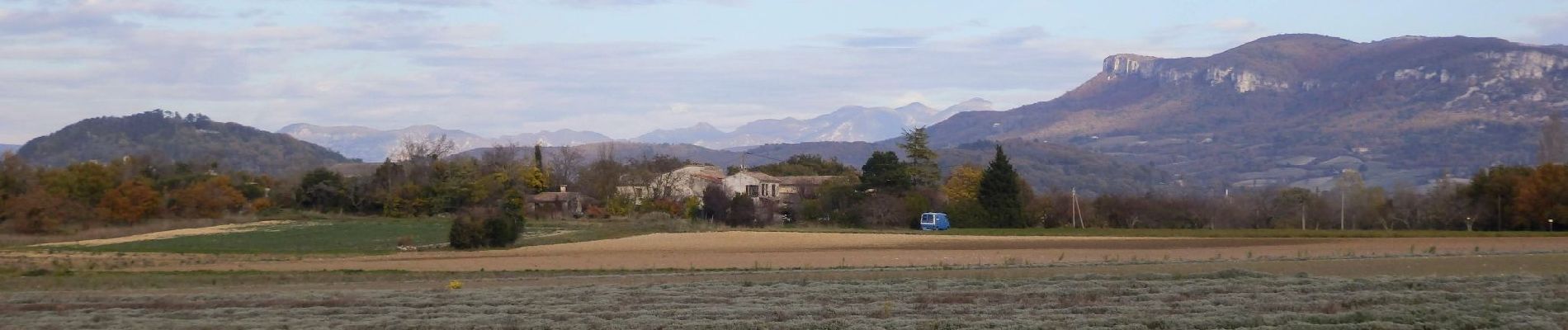
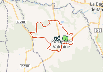
Trail Walking of 7.1 km to be discovered at Auvergne-Rhône-Alpes, Drôme, Portes-en-Valdaine. This trail is proposed by thonyc.
Photos


Positioning
Country:
France
Region :
Auvergne-Rhône-Alpes
Department/Province :
Drôme
Municipality :
Portes-en-Valdaine
Location:
Unknown
Start:(Dec)
Start:(UTM)
651835 ; 4932377 (31T) N.
Comments