


Gaujac

Dupuybadonniere
User
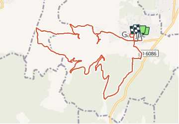

Length
14.9 km

Max alt
263 m

Uphill gradient
316 m
Km-Effort
19.1 km

Min alt
114 m

Downhill gradient
319 m
Boucle
Yes
Creation date :
2021-12-12 08:59:23.201
Updated on :
2021-12-13 07:15:40.65
20h34
Difficulty : Very difficult

FREE GPS app for hiking
 SityTrail
IGN / Geographical institutes
SityTrail Plus
The world is yours!
About
Trail Walking of 14.9 km to be discovered at Occitania, Gard, Gaujac. This trail is proposed by Dupuybadonniere.
Positioning
Country:
France
Region :
Occitania
Department/Province :
Gard
Municipality :
Gaujac
Location:
Unknown
Start:(Dec)
Start:(UTM)
626478 ; 4881667 (31T) N.
Comments