


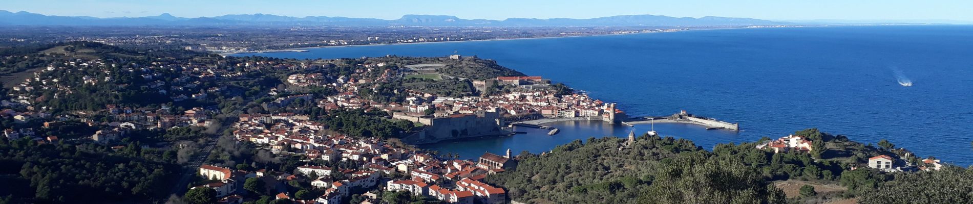
BOUCLE PORT VENDRES - COLLIOURE

acatala
User
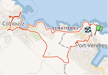

Length
10 km

Max alt
146 m

Uphill gradient
227 m
Km-Effort
13 km

Min alt
0 m

Downhill gradient
225 m
Boucle
Yes
Creation date :
2021-12-12 09:31:17.641
Updated on :
2021-12-13 19:01:50.378
3h22
Difficulty : Easy

FREE GPS app for hiking
 SityTrail
IGN / Geographical institutes
SityTrail Plus
The world is yours!
About
Trail Walking of 10 km to be discovered at Occitania, Pyrénées-Orientales, Port-Vendres. This trail is proposed by acatala.
Description
Aller par le chemin des douaniers ( un passage delicat) et retour par le fort saint Elme.
Photos

Positioning
Country:
France
Region :
Occitania
Department/Province :
Pyrénées-Orientales
Municipality :
Port-Vendres
Location:
Unknown
Start:(Dec)
Start:(UTM)
508760 ; 4707803 (31T) N.
Comments