


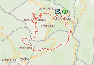
Chazeaux - Ranc Courbier 17/12/21

Linerou
User

Length
11.5 km

Max alt
665 m

Uphill gradient
477 m
Km-Effort
17.9 km

Min alt
302 m

Downhill gradient
480 m
Boucle
Yes
Creation date :
2021-12-16 08:06:52.648
Updated on :
2021-12-16 13:09:59.919
3h22
Difficulty : Medium

FREE GPS app for hiking
 SityTrail
IGN / Geographical institutes
SityTrail Plus
The world is yours!
About
Trail Walking of 11.5 km to be discovered at Auvergne-Rhône-Alpes, Ardèche, Chazeaux. This trail is proposed by Linerou.
Positioning
Country:
France
Region :
Auvergne-Rhône-Alpes
Department/Province :
Ardèche
Municipality :
Chazeaux
Location:
Unknown
Start:(Dec)
Start:(UTM)
604000 ; 4938864 (31T) N.
Comments