


Chemin de la lande

Emmanuelle Benoit
User

Length
41 km

Max alt
283 m

Uphill gradient
391 m
Km-Effort
46 km

Min alt
187 m

Downhill gradient
374 m
Boucle
No
Creation date :
2021-12-18 12:53:33.813
Updated on :
2021-12-18 16:30:30.912
2h02
Difficulty : Easy

FREE GPS app for hiking
 SityTrail
IGN / Geographical institutes
SityTrail Plus
The world is yours!
About
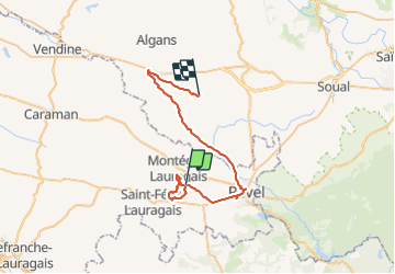
Trail Walking of 41 km to be discovered at Occitania, Haute-Garonne, Roumens. This trail is proposed by Emmanuelle Benoit.
Positioning
Country:
France
Region :
Occitania
Department/Province :
Haute-Garonne
Municipality :
Roumens
Location:
Unknown
Start:(Dec)
Start:(UTM)
413375 ; 4812956 (31T) N.
Comments