


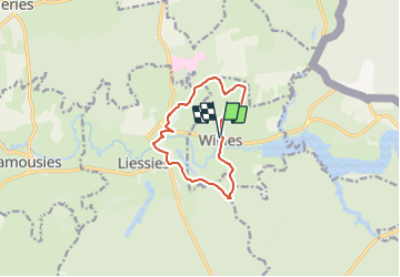
Willies Ste Hiltrude

gabelou41
User

Length
9.2 km

Max alt
231 m

Uphill gradient
162 m
Km-Effort
11.3 km

Min alt
163 m

Downhill gradient
165 m
Boucle
Yes
Creation date :
2021-12-19 07:33:27.418
Updated on :
2021-12-19 07:34:01.234
2h34
Difficulty : Medium

FREE GPS app for hiking
 SityTrail
IGN / Geographical institutes
SityTrail Plus
The world is yours!
About
Trail Walking of 9.2 km to be discovered at Hauts-de-France, Nord, Willies. This trail is proposed by gabelou41.
Positioning
Country:
France
Region :
Hauts-de-France
Department/Province :
Nord
Municipality :
Willies
Location:
Unknown
Start:(Dec)
Start:(UTM)
578527 ; 5552674 (31U) N.
Comments