


SityTrail - 2741834 - 26-puy-st-martin-pr32

thonyc
User GUIDE

Length
16.1 km

Max alt
423 m

Uphill gradient
486 m
Km-Effort
23 km

Min alt
198 m

Downhill gradient
487 m
Boucle
Yes
Creation date :
2021-12-19 17:30:05.339
Updated on :
2022-01-17 16:55:52.356
4h35
Difficulty : Medium

FREE GPS app for hiking
 SityTrail
IGN / Geographical institutes
SityTrail Plus
The world is yours!
About
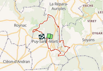
Trail Walking of 16.1 km to be discovered at Auvergne-Rhône-Alpes, Drôme, Puy-Saint-Martin. This trail is proposed by thonyc.
Photos


Positioning
Country:
France
Region :
Auvergne-Rhône-Alpes
Department/Province :
Drôme
Municipality :
Puy-Saint-Martin
Location:
Unknown
Start:(Dec)
Start:(UTM)
656365 ; 4943441 (31T) N.
Comments