


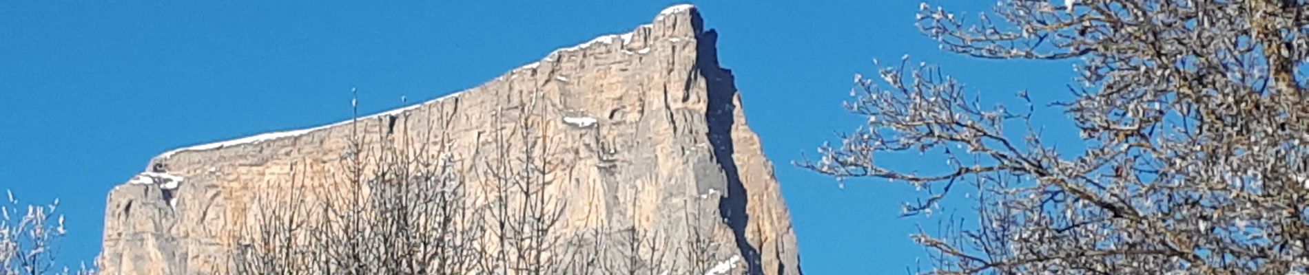
Les Faisses du Gėant

Emelle
User
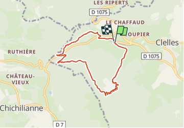

Length
8 km

Max alt
1378 m

Uphill gradient
564 m
Km-Effort
15.5 km

Min alt
832 m

Downhill gradient
563 m
Boucle
Yes
Creation date :
2021-12-19 08:48:27.64
Updated on :
2022-01-08 22:50:09.402
3h31
Difficulty : Medium

FREE GPS app for hiking
 SityTrail
IGN / Geographical institutes
SityTrail Plus
The world is yours!
About
Trail Walking of 8 km to be discovered at Auvergne-Rhône-Alpes, Isère, Clelles. This trail is proposed by Emelle.
Photos


Positioning
Country:
France
Region :
Auvergne-Rhône-Alpes
Department/Province :
Isère
Municipality :
Clelles
Location:
Unknown
Start:(Dec)
Start:(UTM)
705952 ; 4967073 (31T) N.
Comments