


Rochehaut 211221

guyernage25
User
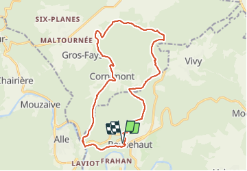

Length
17.1 km

Max alt
430 m

Uphill gradient
571 m
Km-Effort
25 km

Min alt
193 m

Downhill gradient
572 m
Boucle
Yes
Creation date :
2021-12-21 08:11:05.043
Updated on :
2021-12-21 19:30:54.001
4h32
Difficulty : Difficult

FREE GPS app for hiking
 SityTrail
IGN / Geographical institutes
SityTrail Plus
The world is yours!
About
Trail Walking of 17.1 km to be discovered at Wallonia, Luxembourg, Bouillon. This trail is proposed by guyernage25.
Description
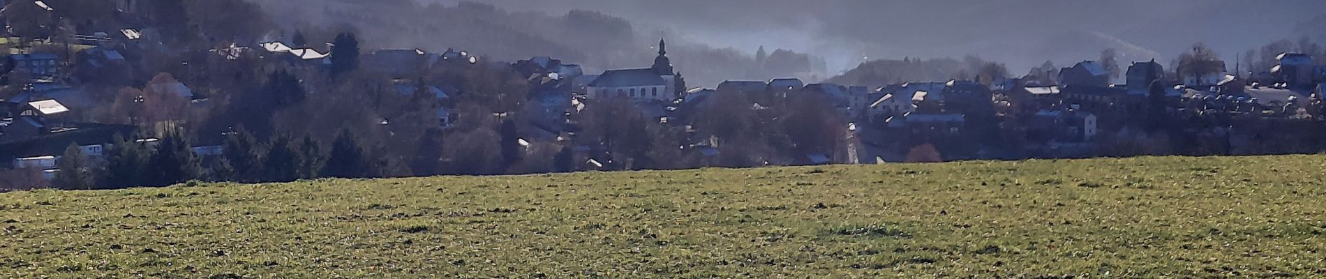
belle rando forestiere avec de beaux paysages
Photos


Positioning
Country:
Belgium
Region :
Wallonia
Department/Province :
Luxembourg
Municipality :
Bouillon
Location:
Unknown
Start:(Dec)
Start:(UTM)
644053 ; 5522882 (31U) N.
Comments