


Gorges du Blavet au col de la pierre du coucou

nadinebondoux
User GUIDE
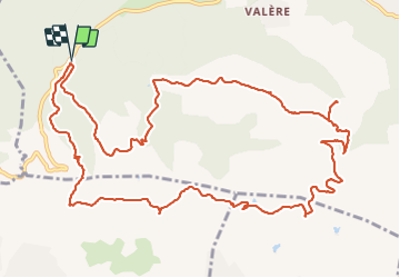

Length
15.8 km

Max alt
419 m

Uphill gradient
486 m
Km-Effort
22 km

Min alt
91 m

Downhill gradient
485 m
Boucle
Yes
Creation date :
2021-12-21 09:26:07.0
Updated on :
2021-12-21 22:21:26.776
4h44
Difficulty : Difficult

FREE GPS app for hiking
 SityTrail
IGN / Geographical institutes
SityTrail Plus
The world is yours!
About
Trail Walking of 15.8 km to be discovered at Provence-Alpes-Côte d'Azur, Var, Bagnols-en-Forêt. This trail is proposed by nadinebondoux.
Description
Par l'oppidum et la forteresse
Photos


24 photos in total. Please click on a photo to see them all in the gallery.
Positioning
Country:
France
Region :
Provence-Alpes-Côte d'Azur
Department/Province :
Var
Municipality :
Bagnols-en-Forêt
Location:
Unknown
Start:(Dec)
Start:(UTM)
310472 ; 4822150 (32T) N.
Comments