


Font d urle

raygautier
User

Length
108 km

Max alt
1638 m

Uphill gradient
1213 m
Km-Effort
129 km

Min alt
111 m

Downhill gradient
2554 m
Boucle
No
Creation date :
2021-12-22 08:27:00.0
Updated on :
2021-12-22 19:20:22.99
6h13
Difficulty : Very difficult

FREE GPS app for hiking
 SityTrail
IGN / Geographical institutes
SityTrail Plus
The world is yours!
About
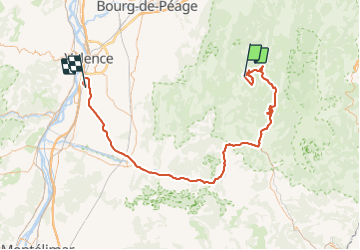
Trail Walking of 108 km to be discovered at Auvergne-Rhône-Alpes, Drôme, Bouvante. This trail is proposed by raygautier.
Positioning
Country:
France
Region :
Auvergne-Rhône-Alpes
Department/Province :
Drôme
Municipality :
Bouvante
Location:
Unknown
Start:(Dec)
Start:(UTM)
683193 ; 4974182 (31T) N.
Comments