


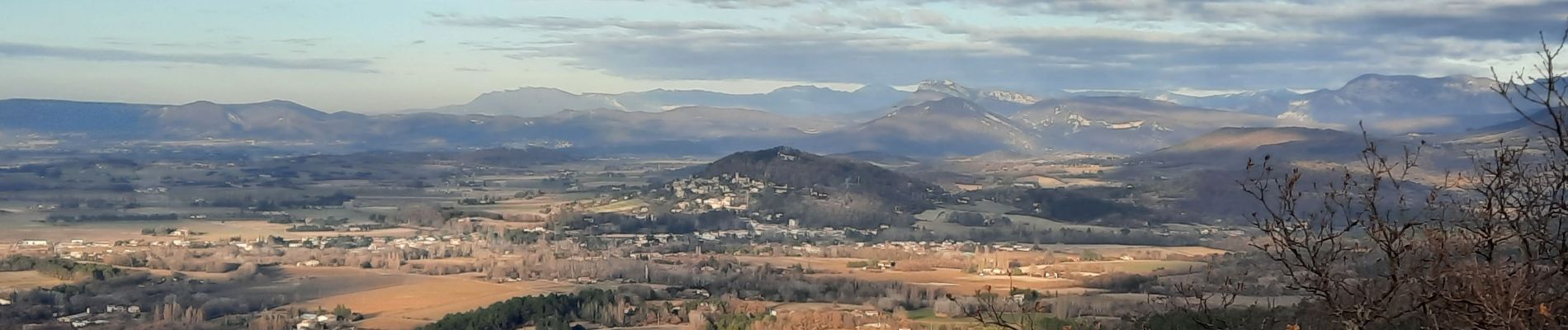
Portes en Valdaine Serres Mirabel et Fournat 16km

thonyc
User GUIDE
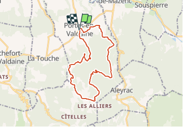

Length
15.9 km

Max alt
458 m

Uphill gradient
423 m
Km-Effort
21 km

Min alt
224 m

Downhill gradient
420 m
Boucle
Yes
Creation date :
2021-12-23 08:36:51.959
Updated on :
2024-09-28 06:35:46.793
4h52
Difficulty : Very difficult

FREE GPS app for hiking
 SityTrail
IGN / Geographical institutes
SityTrail Plus
The world is yours!
About
Trail Walking of 15.9 km to be discovered at Auvergne-Rhône-Alpes, Drôme, Portes-en-Valdaine. This trail is proposed by thonyc.
Photos


Positioning
Country:
France
Region :
Auvergne-Rhône-Alpes
Department/Province :
Drôme
Municipality :
Portes-en-Valdaine
Location:
Unknown
Start:(Dec)
Start:(UTM)
651837 ; 4932380 (31T) N.
Comments