


balade a montalieu-Vercieu

gdela
User

Length
2.2 km

Max alt
221 m

Uphill gradient
12 m
Km-Effort
2.4 km

Min alt
214 m

Downhill gradient
12 m
Boucle
Yes
Creation date :
2021-12-25 12:56:36.68
Updated on :
2021-12-25 14:02:09.304
56m
Difficulty : Very easy

FREE GPS app for hiking
 SityTrail
IGN / Geographical institutes
SityTrail Plus
The world is yours!
About
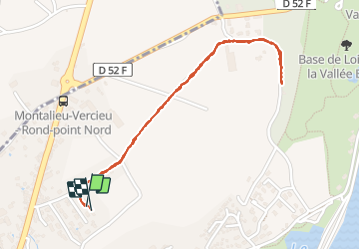
Trail Walking of 2.2 km to be discovered at Auvergne-Rhône-Alpes, Isère, Montalieu-Vercieu. This trail is proposed by gdela.
Positioning
Country:
France
Region :
Auvergne-Rhône-Alpes
Department/Province :
Isère
Municipality :
Montalieu-Vercieu
Location:
Unknown
Start:(Dec)
Start:(UTM)
687032 ; 5076687 (31T) N.
Comments