


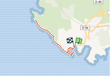
Port de Carro - Sentier du littoral

rigol05
User

Length
6.9 km

Max alt
8 m

Uphill gradient
35 m
Km-Effort
7.4 km

Min alt
0 m

Downhill gradient
35 m
Boucle
Yes
Creation date :
2021-12-27 14:31:12.809
Updated on :
2022-01-04 16:46:07.704
48m
Difficulty : Easy

FREE GPS app for hiking
 SityTrail
IGN / Geographical institutes
SityTrail Plus
The world is yours!
About
Trail Walking of 6.9 km to be discovered at Provence-Alpes-Côte d'Azur, Bouches-du-Rhône, Martigues. This trail is proposed by rigol05.
Description
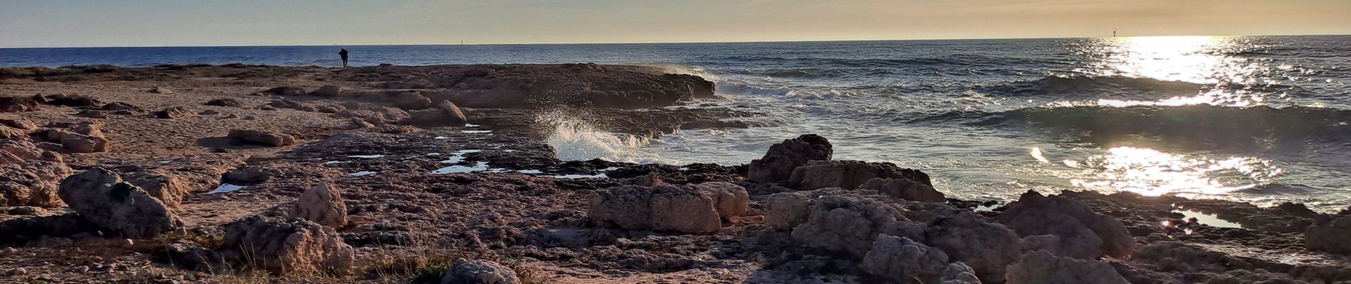
Séjour Côte Bleue - sortie du 27-12-2021
Sentier du littoral Port de Carro A/R
Photos


Positioning
Country:
France
Region :
Provence-Alpes-Côte d'Azur
Department/Province :
Bouches-du-Rhône
Municipality :
Martigues
Location:
Unknown
Start:(Dec)
Start:(UTM)
665596 ; 4799658 (31T) N.
Comments