


CVAD-1

palaco
User
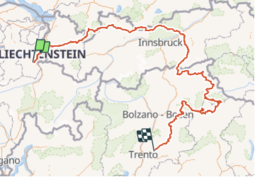

Length
784 km

Max alt
2809 m

Uphill gradient
48241 m
Km-Effort
1427 km

Min alt
452 m

Downhill gradient
47915 m
Boucle
No
Creation date :
2021-12-29 14:03:03.553
Updated on :
2022-02-14 17:21:46.502
10h23
Difficulty : Very difficult

FREE GPS app for hiking
 SityTrail
IGN / Geographical institutes
SityTrail Plus
The world is yours!
About
Trail Walking of 784 km to be discovered at Sankt Gallen, Wahlkreis Sarganserland, Mels. This trail is proposed by palaco.
Positioning
Country:
Switzerland
Region :
Sankt Gallen
Department/Province :
Wahlkreis Sarganserland
Municipality :
Mels
Location:
Unknown
Start:(Dec)
Start:(UTM)
531736 ; 5211215 (32T) N.
Comments