


Roquebrune-Menton 01 2022

coriace
User

Length
9.5 km

Max alt
44 m

Uphill gradient
144 m
Km-Effort
11.5 km

Min alt
0 m

Downhill gradient
153 m
Boucle
No
Creation date :
2022-01-01 12:08:21.965
Updated on :
2022-01-02 13:45:12.586
2h14
Difficulty : Very easy

FREE GPS app for hiking
 SityTrail
IGN / Geographical institutes
SityTrail Plus
The world is yours!
About
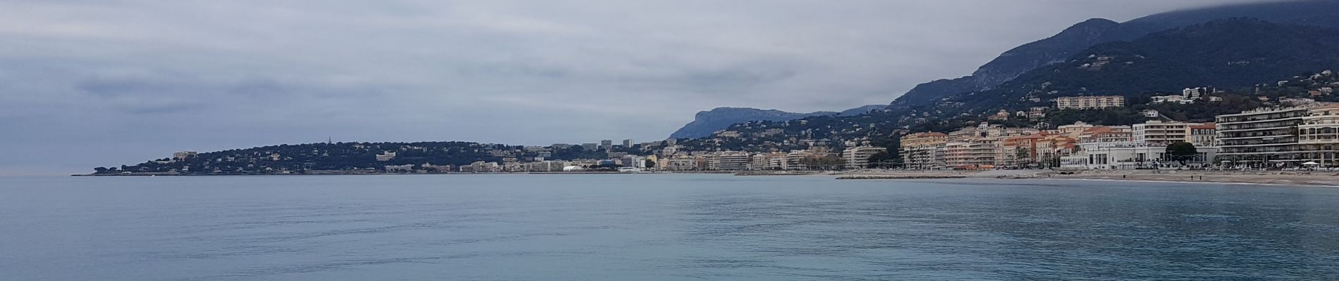
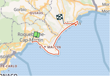
Trail Walking of 9.5 km to be discovered at Provence-Alpes-Côte d'Azur, Maritime Alps, Roquebrune-Cap-Martin. This trail is proposed by coriace.
Description
Départ gare de Roquebrune et arrivée à Menton par le chemin des douaniers .
Photos


Positioning
Country:
France
Region :
Provence-Alpes-Côte d'Azur
Department/Province :
Maritime Alps
Municipality :
Roquebrune-Cap-Martin
Location:
Unknown
Start:(Dec)
Start:(UTM)
375855 ; 4846426 (32T) N.
Comments