Lac St André-2019-02-06

Valmeinier
User
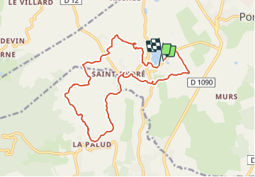

Length
9.4 km

Max alt
484 m

Uphill gradient
222 m
Km-Effort
12.3 km

Min alt
288 m

Downhill gradient
222 m
Boucle
Yes
Creation date :
2022-01-04 07:12:24.956
Updated on :
2022-01-04 07:12:24.956
--
Difficulty : Unknown

FREE GPS app for hiking
 SityTrail
IGN / Geographical institutes
SityTrail Plus
The world is yours!
About
Trail Walking of 9.4 km to be discovered at Auvergne-Rhône-Alpes, Savoy, Porte-de-Savoie. This trail is proposed by Valmeinier.
Positioning
Country:
France
Region :
Auvergne-Rhône-Alpes
Department/Province :
Savoy
Municipality :
Porte-de-Savoie
Location:
Les Marches
Start:(Dec)
Start:(UTM)
733361 ; 5042000 (31T) N.
Comments