


Cruas

raygautier
User
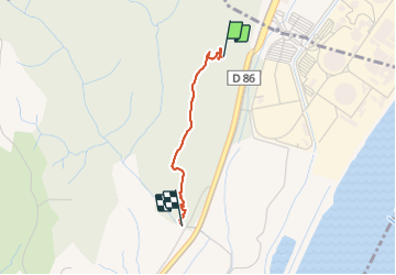

Length
1.7 km

Max alt
259 m

Uphill gradient
64 m
Km-Effort
2.9 km

Min alt
89 m

Downhill gradient
168 m
Boucle
No
Creation date :
2022-01-05 13:32:59.0
Updated on :
2022-01-05 16:13:26.3
1h03
Difficulty : Easy

FREE GPS app for hiking
 SityTrail
IGN / Geographical institutes
SityTrail Plus
The world is yours!
About
Trail Walking of 1.7 km to be discovered at Auvergne-Rhône-Alpes, Ardèche, Meysse. This trail is proposed by raygautier.
Positioning
Country:
France
Region :
Auvergne-Rhône-Alpes
Department/Province :
Ardèche
Municipality :
Meysse
Location:
Unknown
Start:(Dec)
Start:(UTM)
638179 ; 4943576 (31T) N.
Comments