


constentine

luckyy
User
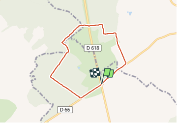

Length
6.3 km

Max alt
305 m

Uphill gradient
108 m
Km-Effort
7.7 km

Min alt
240 m

Downhill gradient
105 m
Boucle
Yes
Creation date :
2022-01-06 12:49:30.867
Updated on :
2022-01-06 15:22:16.251
2h32
Difficulty : Medium

FREE GPS app for hiking
 SityTrail
IGN / Geographical institutes
SityTrail Plus
The world is yours!
About
Trail Walking of 6.3 km to be discovered at Grand Est, Meuse, Rouvrois-sur-Othain. This trail is proposed by luckyy.
Positioning
Country:
France
Region :
Grand Est
Department/Province :
Meuse
Municipality :
Rouvrois-sur-Othain
Location:
Unknown
Start:(Dec)
Start:(UTM)
690394 ; 5475033 (31U) N.
Comments