


Gramondo

PEBREJOSIANE
User
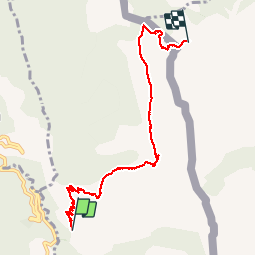

Length
7.2 km

Max alt
1368 m

Uphill gradient
1066 m
Km-Effort
17.9 km

Min alt
305 m

Downhill gradient
14 m
Boucle
No
Creation date :
2014-12-10 00:00:00.0
Updated on :
2014-12-10 00:00:00.0
3h03
Difficulty : Medium

FREE GPS app for hiking
 SityTrail
IGN / Geographical institutes
SityTrail Plus
The world is yours!
About
Trail Walking of 7.2 km to be discovered at Provence-Alpes-Côte d'Azur, Maritime Alps, Castellar. This trail is proposed by PEBREJOSIANE.
Description
Aller simple
Au départ de la route de Castellar (premier embranchement après Monti)
On pourra revenir par le même chemin, ou passer versant Italien
Photos


Positioning
Country:
France
Region :
Provence-Alpes-Côte d'Azur
Department/Province :
Maritime Alps
Municipality :
Castellar
Location:
Unknown
Start:(Dec)
Start:(UTM)
378554 ; 4852857 (32T) N.
Comments