


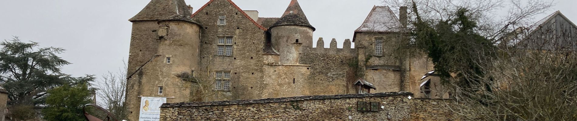
Ponthus de thiard

margotjl
User

Length
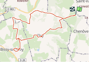
12.3 km

Max alt
412 m

Uphill gradient
326 m
Km-Effort
16.6 km

Min alt
277 m

Downhill gradient
325 m
Boucle
Yes
Creation date :
2022-01-07 08:51:41.0
Updated on :
2022-01-07 12:22:50.237
3h30
Difficulty : Medium

FREE GPS app for hiking
 SityTrail
IGN / Geographical institutes
SityTrail Plus
The world is yours!
About
Trail Walking of 12.3 km to be discovered at Bourgogne-Franche-Comté, Saône-et-Loire, Chenôves. This trail is proposed by margotjl.
Photos


Positioning
Country:
France
Region :
Bourgogne-Franche-Comté
Department/Province :
Saône-et-Loire
Municipality :
Chenôves
Location:
Unknown
Start:(Dec)
Start:(UTM)
627371 ; 5170913 (31T) N.
Comments