Les cuves du duzon

raygautier
User
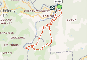

Length
10.5 km

Max alt
452 m

Uphill gradient
481 m
Km-Effort
16.9 km

Min alt
182 m

Downhill gradient
489 m
Boucle
Yes
Creation date :
2022-01-09 09:33:55.0
Updated on :
2022-01-09 16:01:21.592
5h13
Difficulty : Difficult

FREE GPS app for hiking
 SityTrail
IGN / Geographical institutes
SityTrail Plus
The world is yours!
About
Trail Walking of 10.5 km to be discovered at Auvergne-Rhône-Alpes, Ardèche, Tournon-sur-Rhône. This trail is proposed by raygautier.
Positioning
Country:
France
Region :
Auvergne-Rhône-Alpes
Department/Province :
Ardèche
Municipality :
Tournon-sur-Rhône
Location:
Unknown
Start:(Dec)
Start:(UTM)
640554 ; 4990769 (31T) N.
Comments