


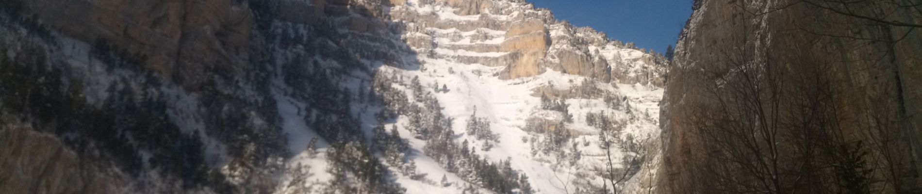
Archiane sous le neige

Atchoum26
User
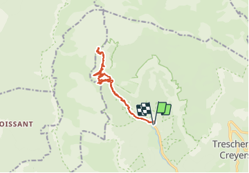

Length
15.1 km

Max alt
1726 m

Uphill gradient
2317 m
Km-Effort
46 km

Min alt
755 m

Downhill gradient
2323 m
Boucle
Yes
Creation date :
2022-01-10 07:18:15.165
Updated on :
2022-01-10 16:05:29.063
8h20
Difficulty : Very difficult

FREE GPS app for hiking
 SityTrail
IGN / Geographical institutes
SityTrail Plus
The world is yours!
About
Trail Walking of 15.1 km to be discovered at Auvergne-Rhône-Alpes, Drôme, Châtillon-en-Diois. This trail is proposed by Atchoum26.
Photos


Positioning
Country:
France
Region :
Auvergne-Rhône-Alpes
Department/Province :
Drôme
Municipality :
Châtillon-en-Diois
Location:
Treschenu-Creyers
Start:(Dec)
Start:(UTM)
698456 ; 4957755 (31T) N.
Comments