


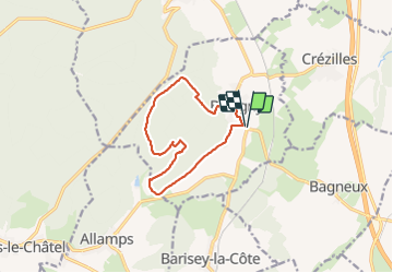
bulligny_10km

ZAMBAUX
User

Length
10.6 km

Max alt
420 m

Uphill gradient
239 m
Km-Effort
13.8 km

Min alt
285 m

Downhill gradient
239 m
Boucle
Yes
Creation date :
2022-01-11 13:03:08.182
Updated on :
2022-01-11 15:49:45.513
2h45
Difficulty : Difficult

FREE GPS app for hiking
 SityTrail
IGN / Geographical institutes
SityTrail Plus
The world is yours!
About
Trail Walking of 10.6 km to be discovered at Grand Est, Meurthe-et-Moselle, Bulligny. This trail is proposed by ZAMBAUX.
Positioning
Country:
France
Region :
Grand Est
Department/Province :
Meurthe-et-Moselle
Municipality :
Bulligny
Location:
Unknown
Start:(Dec)
Start:(UTM)
710577 ; 5383719 (31U) N.
Comments