


SityTrail - Puy St Martin La Pigne-Saudon 8,5km

thonyc
User GUIDE
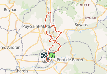

Length
13.9 km

Max alt
520 m

Uphill gradient
537 m
Km-Effort
21 km

Min alt
221 m

Downhill gradient
536 m
Boucle
Yes
Creation date :
2022-01-11 16:18:13.15
Updated on :
2022-01-18 14:40:09.161
4h30
Difficulty : Medium

FREE GPS app for hiking
 SityTrail
IGN / Geographical institutes
SityTrail Plus
The world is yours!
About
Trail Walking of 13.9 km to be discovered at Auvergne-Rhône-Alpes, Drôme, Manas. This trail is proposed by thonyc.
Description
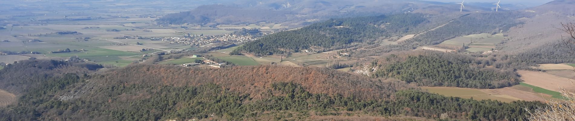
Panorama au Bélvédère des Fours
Photos


Positioning
Country:
France
Region :
Auvergne-Rhône-Alpes
Department/Province :
Drôme
Municipality :
Manas
Location:
Unknown
Start:(Dec)
Start:(UTM)
657478 ; 4940309 (31T) N.
Comments