


Les moulins de Longvilliers

canal
User

Length
7.5 km

Max alt
111 m

Uphill gradient
54 m
Km-Effort
8.3 km

Min alt
84 m

Downhill gradient
71 m
Boucle
No
Creation date :
2022-01-11 17:33:33.245
Updated on :
2022-01-11 17:37:52.825
1h53
Difficulty : Medium

FREE GPS app for hiking
 SityTrail
IGN / Geographical institutes
SityTrail Plus
The world is yours!
About
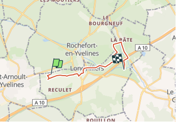
Trail Walking of 7.5 km to be discovered at Ile-de-France, Yvelines, Longvilliers. This trail is proposed by canal.
Description
De Saint Fargeau à Morsang par les Echelettes, la Forge, et la Bâte, 7,5 km
Positioning
Country:
France
Region :
Ile-de-France
Department/Province :
Yvelines
Municipality :
Longvilliers
Location:
Unknown
Start:(Dec)
Start:(UTM)
423733 ; 5380784 (31U) N.
Comments