


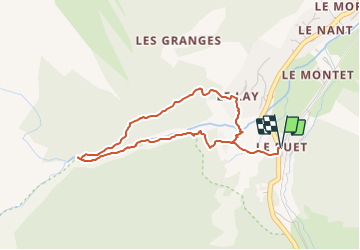
18 - La Cascade de Bèrard

geranimo
User

Length
3.8 km

Max alt
1539 m

Uphill gradient
209 m
Km-Effort
6.6 km

Min alt
1344 m

Downhill gradient
209 m
Boucle
Yes
Creation date :
2022-01-14 16:22:35.175
Updated on :
2022-02-06 18:07:33.821
1h29
Difficulty : Medium

FREE GPS app for hiking
 SityTrail
IGN / Geographical institutes
SityTrail Plus
The world is yours!
About
Trail Walking of 3.8 km to be discovered at Auvergne-Rhône-Alpes, Upper Savoy, Vallorcine. This trail is proposed by geranimo.
Positioning
Country:
France
Region :
Auvergne-Rhône-Alpes
Department/Province :
Upper Savoy
Municipality :
Vallorcine
Location:
Unknown
Start:(Dec)
Start:(UTM)
338987 ; 5098264 (32T) N.
Comments