


pic des perdrix

petit-pied
User
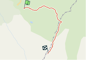

Length
2.9 km

Max alt
2211 m

Uphill gradient
662 m
Km-Effort
9.5 km

Min alt
1551 m

Downhill gradient
4 m
Boucle
No
Creation date :
2022-01-16 09:41:45.019
Updated on :
2022-01-16 17:05:47.356
6h28
Difficulty : Medium

FREE GPS app for hiking
 SityTrail
IGN / Geographical institutes
SityTrail Plus
The world is yours!
About
Trail Walking of 2.9 km to be discovered at Occitania, Ariège, Val-de-Sos. This trail is proposed by petit-pied.
Positioning
Country:
France
Region :
Occitania
Department/Province :
Ariège
Municipality :
Val-de-Sos
Location:
Goulier
Start:(Dec)
Start:(UTM)
378563 ; 4732903 (31T) N.
Comments