


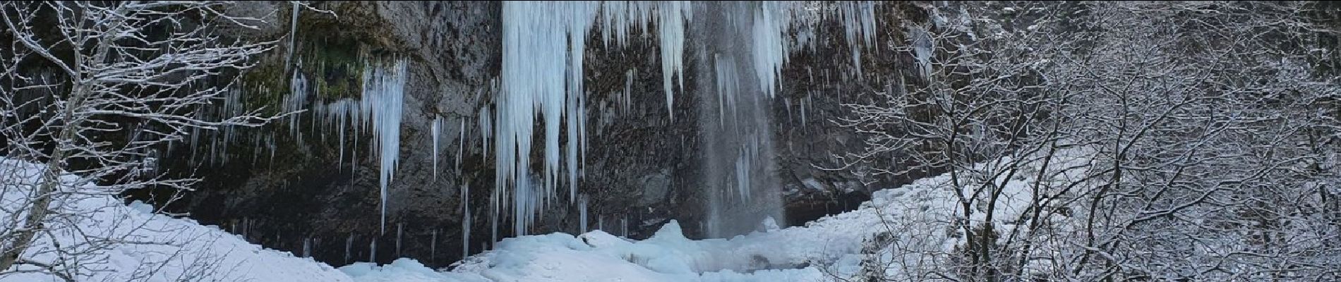
Cascades7

rollondesbois
User
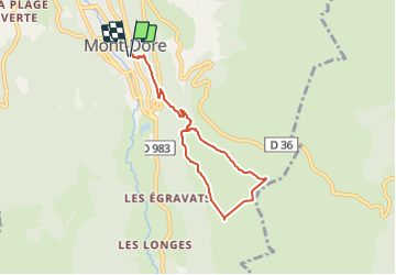

Length
7.3 km

Max alt
1514 m

Uphill gradient
458 m
Km-Effort
13.4 km

Min alt
1046 m

Downhill gradient
458 m
Boucle
Yes
Creation date :
2022-01-21 09:32:07.967
Updated on :
2022-01-21 17:38:52.905
3h02
Difficulty : Difficult

FREE GPS app for hiking
 SityTrail
IGN / Geographical institutes
SityTrail Plus
The world is yours!
About
Trail Walking of 7.3 km to be discovered at Auvergne-Rhône-Alpes, Puy-de-Dôme, Mont-Dore. This trail is proposed by rollondesbois.
Photos


Positioning
Country:
France
Region :
Auvergne-Rhône-Alpes
Department/Province :
Puy-de-Dôme
Municipality :
Mont-Dore
Location:
Unknown
Start:(Dec)
Start:(UTM)
485202 ; 5046703 (31T) N.
Comments