


cimetière de Vayres

SUPERMAMINOU2004
User

Length
7.3 km

Max alt
141 m

Uphill gradient
101 m
Km-Effort
8.6 km

Min alt
66 m

Downhill gradient
104 m
Boucle
Yes
Creation date :
2022-01-24 08:40:19.829
Updated on :
2022-01-24 10:42:52.867
2h02
Difficulty : Medium

FREE GPS app for hiking
 SityTrail
IGN / Geographical institutes
SityTrail Plus
The world is yours!
About
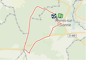
Trail Walking of 7.3 km to be discovered at Ile-de-France, Essonne, Vayres-sur-Essonne. This trail is proposed by SUPERMAMINOU2004.
Positioning
Country:
France
Region :
Ile-de-France
Department/Province :
Essonne
Municipality :
Vayres-sur-Essonne
Location:
Unknown
Start:(Dec)
Start:(UTM)
451884 ; 5365297 (31U) N.
Comments