


arboras arsel

labarone
User

Length
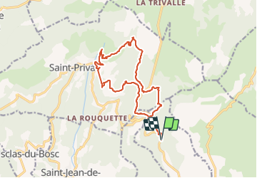
17.9 km

Max alt
750 m

Uphill gradient
798 m
Km-Effort
29 km

Min alt
306 m

Downhill gradient
796 m
Boucle
Yes
Creation date :
2022-01-25 08:09:18.48
Updated on :
2022-01-25 15:54:08.549
4h52
Difficulty : Medium

FREE GPS app for hiking
 SityTrail
IGN / Geographical institutes
SityTrail Plus
The world is yours!
About
Trail Walking of 17.9 km to be discovered at Occitania, Hérault, Arboras. This trail is proposed by labarone.
Description
1 er km non enregistré donc à ajouter
dernière descente à risque soyez prudents.
passage aussi au milieu d'un troupeau bovins... être prudent
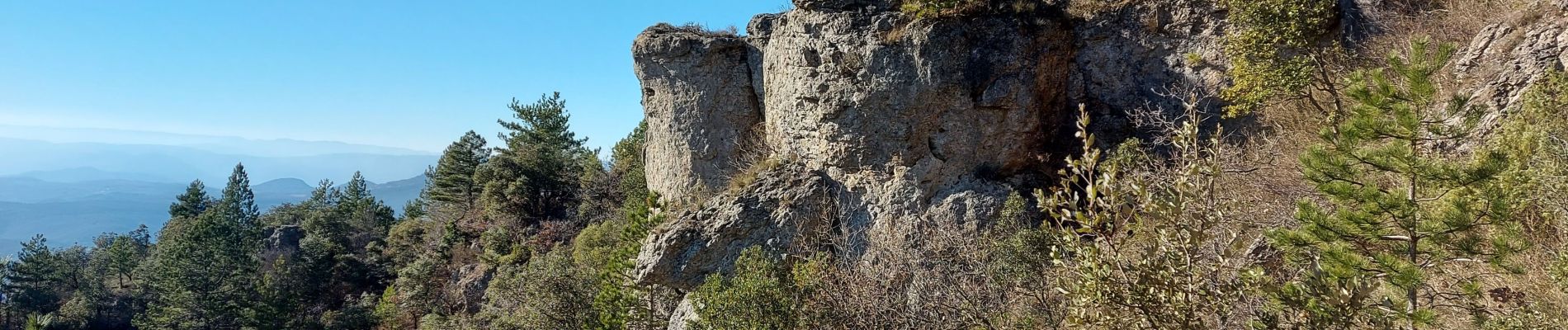
Photos


Positioning
Country:
France
Region :
Occitania
Department/Province :
Hérault
Municipality :
Arboras
Location:
Unknown
Start:(Dec)
Start:(UTM)
537682 ; 4841787 (31T) N.
Comments