


choignes

janussity
User
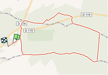

Length
11 km

Max alt
395 m

Uphill gradient
129 m
Km-Effort
12.8 km

Min alt
324 m

Downhill gradient
141 m
Boucle
No
Creation date :
2022-01-26 12:55:47.589
Updated on :
2022-01-26 15:45:55.388
2h29
Difficulty : Medium

FREE GPS app for hiking
 SityTrail
IGN / Geographical institutes
SityTrail Plus
The world is yours!
About
Trail Walking of 11 km to be discovered at Grand Est, Haute-Marne, Chaumont. This trail is proposed by janussity.
Positioning
Country:
France
Region :
Grand Est
Department/Province :
Haute-Marne
Municipality :
Chaumont
Location:
Unknown
Start:(Dec)
Start:(UTM)
663067 ; 5332381 (31U) N.
Comments