


rando

Tommy Eric
User
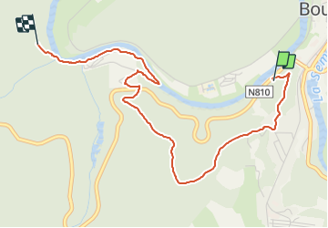

Length
3.8 km

Max alt
337 m

Uphill gradient
168 m
Km-Effort
6 km

Min alt
211 m

Downhill gradient
147 m
Boucle
No
Creation date :
2022-01-29 12:38:44.462
Updated on :
2022-01-29 14:12:06.146
1h33
Difficulty : Easy

FREE GPS app for hiking
 SityTrail
IGN / Geographical institutes
SityTrail Plus
The world is yours!
About
Trail Walking of 3.8 km to be discovered at Wallonia, Luxembourg, Bouillon. This trail is proposed by Tommy Eric.
Positioning
Country:
Belgium
Region :
Wallonia
Department/Province :
Luxembourg
Municipality :
Bouillon
Location:
Unknown
Start:(Dec)
Start:(UTM)
648396 ; 5517388 (31U) N.
Comments