


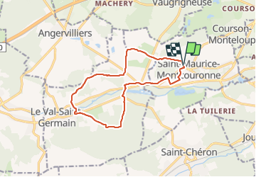
30-01-22 Rando Saint Maurice Montcouronne

jchezlemas
User

Length
12.8 km

Max alt
124 m

Uphill gradient
212 m
Km-Effort
15.6 km

Min alt
64 m

Downhill gradient
210 m
Boucle
Yes
Creation date :
2022-01-30 13:28:59.524
Updated on :
2022-01-30 17:42:04.399
3h03
Difficulty : Easy

FREE GPS app for hiking
 SityTrail
IGN / Geographical institutes
SityTrail Plus
The world is yours!
About
Trail Walking of 12.8 km to be discovered at Ile-de-France, Essonne, Saint-Maurice-Montcouronne. This trail is proposed by jchezlemas.
Positioning
Country:
France
Region :
Ile-de-France
Department/Province :
Essonne
Municipality :
Saint-Maurice-Montcouronne
Location:
Unknown
Start:(Dec)
Start:(UTM)
435230 ; 5381382 (31U) N.
Comments