


Charrecey Le Montabon page 29

grasgilbert
User
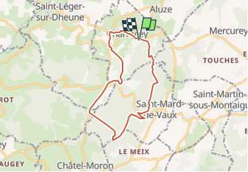

Length
12.9 km

Max alt
498 m

Uphill gradient
382 m
Km-Effort
18 km

Min alt
303 m

Downhill gradient
381 m
Boucle
Yes
Creation date :
2022-02-04 10:03:32.065
Updated on :
2023-02-10 09:32:16.014
3h59
Difficulty : Difficult

FREE GPS app for hiking
 SityTrail
IGN / Geographical institutes
SityTrail Plus
The world is yours!
About
Trail Walking of 12.9 km to be discovered at Bourgogne-Franche-Comté, Saône-et-Loire, Charrecey. This trail is proposed by grasgilbert.
Description
monter dans le S de sapinière pour rejoindre le grand chemin
Positioning
Country:
France
Region :
Bourgogne-Franche-Comté
Department/Province :
Saône-et-Loire
Municipality :
Charrecey
Location:
Unknown
Start:(Dec)
Start:(UTM)
627683 ; 5188345 (31T) N.
Comments
bien