


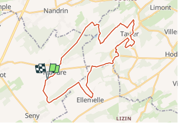
Promenade de la Ramette

Commissariat général au Tourisme
Randonnées du CGT GUIDE+

Length
19.1 km

Max alt
303 m

Uphill gradient
341 m
Km-Effort
24 km

Min alt
187 m

Downhill gradient
342 m
Boucle
Yes
Creation date :
2022-02-08 11:24:40.935
Updated on :
2022-02-21 10:06:05.051
1h38
Difficulty : Medium

FREE GPS app for hiking
 SityTrail
IGN / Geographical institutes
SityTrail Plus
The world is yours!
About
Trail Mountain bike of 19.1 km to be discovered at Wallonia, Liège, Tinlot. This trail is proposed by Commissariat général au Tourisme.
Description
Trail created by Terres-de-Meuse.
Photos

Positioning
Country:
Belgium
Region :
Wallonia
Department/Province :
Liège
Municipality :
Tinlot
Location:
Unknown
Start:(Dec)
Start:(UTM)
671272 ; 5594311 (31U) N.
Comments