


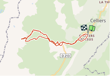
col de la Valette

CABERMAT
User

Length
9.2 km

Max alt
2342 m

Uphill gradient
971 m
Km-Effort
22 km

Min alt
1357 m

Downhill gradient
983 m
Boucle
Yes
Creation date :
2022-02-08 08:23:38.159
Updated on :
2022-02-08 14:20:15.628
5h55
Difficulty : Very easy

FREE GPS app for hiking
 SityTrail
IGN / Geographical institutes
SityTrail Plus
The world is yours!
About
Trail Touring skiing of 9.2 km to be discovered at Auvergne-Rhône-Alpes, Savoy, La Léchère. This trail is proposed by CABERMAT.
Positioning
Country:
France
Region :
Auvergne-Rhône-Alpes
Department/Province :
Savoy
Municipality :
La Léchère
Location:
Celliers
Start:(Dec)
Start:(UTM)
297922 ; 5038762 (32T) N.
Comments