


Terres rouges avec Amélie

acatala
User
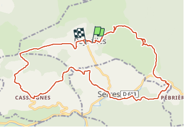

Length
14.9 km

Max alt
437 m

Uphill gradient
380 m
Km-Effort
20 km

Min alt
269 m

Downhill gradient
404 m
Boucle
Yes
Creation date :
2022-02-09 10:17:10.219
Updated on :
2022-02-09 15:35:49.582
5h17
Difficulty : Very difficult

FREE GPS app for hiking
 SityTrail
IGN / Geographical institutes
SityTrail Plus
The world is yours!
About
Trail Walking of 14.9 km to be discovered at Occitania, Aude, Peyrolles. This trail is proposed by acatala.
Positioning
Country:
France
Region :
Occitania
Department/Province :
Aude
Municipality :
Peyrolles
Location:
Unknown
Start:(Dec)
Start:(UTM)
444383 ; 4756535 (31T) N.
Comments