


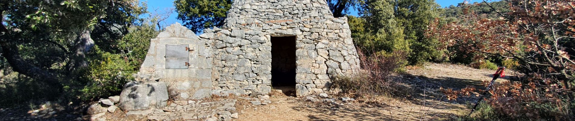
Les Aiguiers du Villars

MarcLEBARON
User

Length
15.8 km

Max alt
807 m

Uphill gradient
687 m
Km-Effort
25 km

Min alt
366 m

Downhill gradient
696 m
Boucle
Yes
Creation date :
2022-02-09 08:31:45.981
Updated on :
2022-02-10 08:48:08.119
4h52
Difficulty : Difficult

FREE GPS app for hiking
 SityTrail
IGN / Geographical institutes
SityTrail Plus
The world is yours!
About
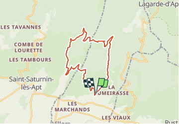
Trail Walking of 15.8 km to be discovered at Provence-Alpes-Côte d'Azur, Vaucluse, Villars. This trail is proposed by MarcLEBARON.
Photos


27 photos in total. Please click on a photo to see them all in the gallery.
Positioning
Country:
France
Region :
Provence-Alpes-Côte d'Azur
Department/Province :
Vaucluse
Municipality :
Villars
Location:
Unknown
Start:(Dec)
Start:(UTM)
695016 ; 4867941 (31T) N.
Comments