


arnouillaz

fab4u
User
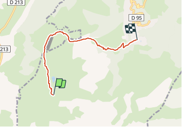

Length
4.9 km

Max alt
2015 m

Uphill gradient
8 m
Km-Effort
6.9 km

Min alt
1448 m

Downhill gradient
566 m
Boucle
No
Creation date :
2022-02-10 09:12:22.059
Updated on :
2022-02-10 11:58:37.209
1h40
Difficulty : Medium

FREE GPS app for hiking
 SityTrail
IGN / Geographical institutes
SityTrail Plus
The world is yours!
About
Trail Walking of 4.9 km to be discovered at Auvergne-Rhône-Alpes, Savoy, Les Avanchers-Valmorel. This trail is proposed by fab4u.
Positioning
Country:
France
Region :
Auvergne-Rhône-Alpes
Department/Province :
Savoy
Municipality :
Les Avanchers-Valmorel
Location:
Unknown
Start:(Dec)
Start:(UTM)
297840 ; 5035400 (32T) N.
Comments