


L'Eléphant de Pierre et les aiguilles de Valbelle 2

boulinevelyne
User
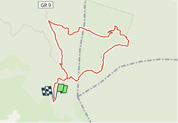

Length
10.1 km

Max alt
644 m

Uphill gradient
278 m
Km-Effort
13.8 km

Min alt
437 m

Downhill gradient
274 m
Boucle
Yes
Creation date :
2022-02-11 16:59:14.291
Updated on :
2024-03-01 08:21:43.032
3h07
Difficulty : Difficult

FREE GPS app for hiking
 SityTrail
IGN / Geographical institutes
SityTrail Plus
The world is yours!
About
Trail Walking of 10.1 km to be discovered at Provence-Alpes-Côte d'Azur, Var, Signes. This trail is proposed by boulinevelyne.
Description
Rajouter 2 Km AR pour l'éléphant de Pierre
au départ de " l'Abîme des morts
Positioning
Country:
France
Region :
Provence-Alpes-Côte d'Azur
Department/Province :
Var
Municipality :
Signes
Location:
Unknown
Start:(Dec)
Start:(UTM)
737245 ; 4790492 (31T) N.
Comments