


GTMC J5

PhilippeC54
User
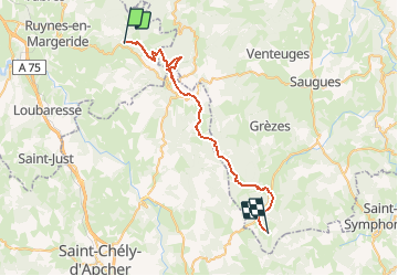

Length
37 km

Max alt
1494 m

Uphill gradient
1068 m
Km-Effort
51 km

Min alt
1097 m

Downhill gradient
1023 m
Boucle
No
Creation date :
2014-12-10 00:00:00.0
Updated on :
2014-12-10 00:00:00.0
3h17
Difficulty : Medium

FREE GPS app for hiking
 SityTrail
IGN / Geographical institutes
SityTrail Plus
The world is yours!
About
Trail Mountain bike of 37 km to be discovered at Auvergne-Rhône-Alpes, Cantal, Clavières. This trail is proposed by PhilippeC54.
Description
15: Auzenc
16: Le Sauvage
Positioning
Country:
France
Region :
Auvergne-Rhône-Alpes
Department/Province :
Cantal
Municipality :
Clavières
Location:
Unknown
Start:(Dec)
Start:(UTM)
524281 ; 4982249 (31T) N.
Comments