


GTMC J6

PhilippeC54
User
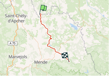

Length
58 km

Max alt
1496 m

Uphill gradient
1060 m
Km-Effort
73 km

Min alt
1195 m

Downhill gradient
1122 m
Boucle
No
Creation date :
2014-12-10 00:00:00.0
Updated on :
2014-12-10 00:00:00.0
4h42
Difficulty : Medium

FREE GPS app for hiking
 SityTrail
IGN / Geographical institutes
SityTrail Plus
The world is yours!
About
Trail Mountain bike of 58 km to be discovered at Auvergne-Rhône-Alpes, Haute-Loire, Chanaleilles. This trail is proposed by PhilippeC54.
Description
17: La Croix du Bas
18: Le Giraldès
19: Laubert
20: Bonnétès
Positioning
Country:
France
Region :
Auvergne-Rhône-Alpes
Department/Province :
Haute-Loire
Municipality :
Chanaleilles
Location:
Unknown
Start:(Dec)
Start:(UTM)
538544 ; 4963556 (31T) N.
Comments