


Pologne Hamoir

Thierry Deppe
User
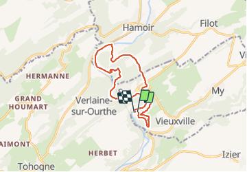

Length
12.2 km

Max alt
231 m

Uphill gradient
330 m
Km-Effort
16.6 km

Min alt
113 m

Downhill gradient
333 m
Boucle
Yes
Creation date :
2022-02-12 11:28:36.0
Updated on :
2022-02-12 23:56:40.698
3h24
Difficulty : Medium

FREE GPS app for hiking
 SityTrail
IGN / Geographical institutes
SityTrail Plus
The world is yours!
About
Trail Walking of 12.2 km to be discovered at Wallonia, Liège, Ferrières. This trail is proposed by Thierry Deppe.
Description
Avec le haut du rocher
Attention amateur s abstenir
Très pentu
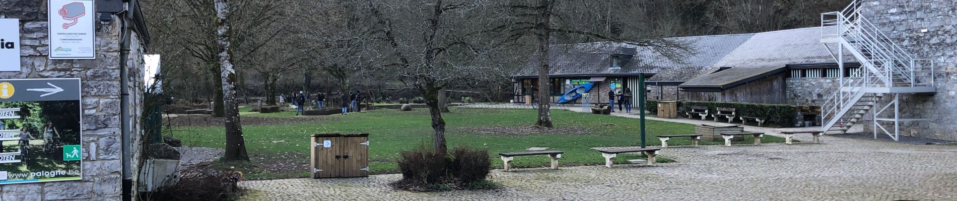
Photos


Positioning
Country:
Belgium
Region :
Wallonia
Department/Province :
Liège
Municipality :
Ferrières
Location:
Unknown
Start:(Dec)
Start:(UTM)
679978 ; 5585998 (31U) N.
Comments